
Tuesday, 11/11/2025 16:00
(GMT+7)
Assessing flood situation and building digital flood map for natural disaster prevention and control
HNN.VN - Following the directive from the Chairman of Hue City People's Committee, on November 10, Hue City Civil Defense Steering Committee issued an official dispatch requesting the People's Committees of wards and communes in the city to conduct surveys to mark the highest flood traces during the flooding event, from October 25 to November 3, within the premises of offices, schools, low-lying routes, public works, and flood warning towers in the local areas.
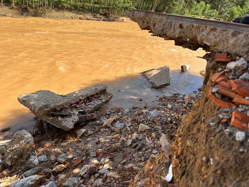 |
| Heavy rain caused stream bank erosion, affecting the lives of residents in Khe Tre Commune |
Accordingly, the localities need to identify the flooded locations and report the data in their communes and wards, using the provided form, sending to the City Department of Agriculture and Rural Development (via the Sub-Department of Water Resources and Climate Change) before November 30 for compilation and submission to the Department of Science and Technology, which will update the digital flood map to serve the city's natural disaster prevention and control efforts.
This is a necessary and urgent action to serve the investigation and assessment of the flood situation and the construction of the digital flood map; to support localities in developing natural disaster response plans, and to promptly advise the City People's Committee on directing and managing the response to floods in the coming time.
By PHONG ANH